Ever green app for my use during my trips. Recommended to download for maps and navigation. User interface is excellent and very much attractive

1,000,000+
Navigate Smarter With Complete Travel Tools
Stop juggling multiple apps. Get voice navigation, live street views, traffic updates, and essential travel utilities all in one powerful navigation companion.
1,000,000+
Navigate Smarter With Complete Travel Tools
Stop juggling multiple apps. Get voice navigation, live street views, traffic updates, and essential travel utilities all in one powerful navigation companion.
Everything You Need For Confident Travel
1
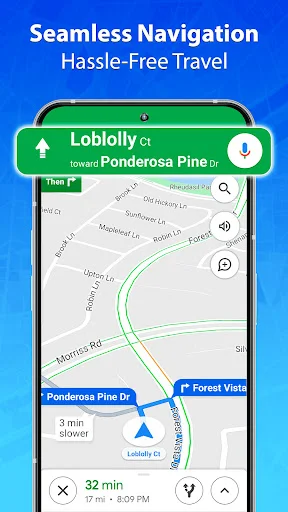
Clear Voice Guided Navigation
Follow turn-by-turn directions with spoken guidance so you can keep your eyes on the road. Compare multiple routes and choose the best path for every trip, whether it's a quick errand or a long journey.
2
Preview Before You Drive
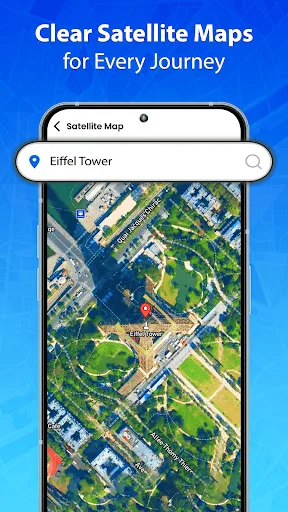
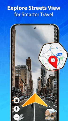
Explore unfamiliar streets with live satellite and street view before you arrive. See the actual roads, landmarks, and surroundings so there are no surprises when you get there.
3
All Travel Utilities Together
Access weather forecasts, compass, speedometer, fuel calculator, and nearby places all in one app. No more switching between apps – get everything you need for complete trip planning and navigation.
4
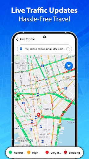
Beat Traffic And Delays
Check real-time traffic updates and compare alternate routes to avoid congestion. Save time by choosing the fastest path and finding nearby fuel stations, restaurants, and services along the way.
About
Live Street View: Route Planner - Explore Roads And Plan Trips With Confidence!
Plan daily drives, city trips, and longer journeys with spoken guidance, route tools, and useful travel information. Search destinations, review paths, and check your position without juggling separate utilities.
Live GPS Satellite Map: GPS Coordinates gives you precise location details when an address alone is not enough. GPS Navigation: Map Direction supports turn-by-turn guidance so you can stay focused while moving.
Navigation And Travel Features:
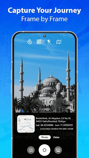
- GPS Camera Live Earth Map - Capture pictures with location details
- Live Satellite View: GPS Location - Explore areas with detailed imagery
- GPS Maps Navigation App - Search destinations and follow optimized routes
- GPS Earth Map: Streetview - Look around streets before you arrive
- Live View Voice Map: Driving Directions - Hear spoken instructions for turns and exits
- Satellite View: Live Map Location App - Explore roads and terrain from above
- Line Distance Tool - Measure straight-line distance between two points
- Traffic Updates - Check congestion and consider alternate paths
- Travel Utilities - Use compass, weather, speedometer, stopwatch, and fuel tools
Search a place, compare routes, and follow clear guidance along the way!
GPS Camera Live Earth Map is useful for documenting trips with coordinate information. Live Satellite View: GPS Location provides another way to understand unfamiliar surroundings.
How To Use:
- Open GPS Maps Navigation App and enter an address or destination
- Use GPS Navigation: Map Direction to review the suggested path
- Start Live View Voice Map: Driving Directions when you want spoken guidance
- Check GPS Earth Map: Streetview to preview unfamiliar streets
- Open Satellite View: Live Map Location App for an overhead view
- Use Live GPS Satellite Map: GPS Coordinates when exact position details are useful
- Save frequently visited addresses for quicker access later
Routes, Traffic, And Nearby Places:
Live Street View: Route Planner helps compare possible paths for short commutes or longer trips. Traffic information can help you notice congestion and choose another way when available. GPS Maps Navigation App can also help locate restaurants, fuel stations, ATMs, hotels, hospitals, police stations, and fire stations nearby.
Imagery, Coordinates, And Location Tools:
Live GPS Satellite Map: GPS Coordinates can display latitude and longitude for your current or selected position. GPS Earth Map: Streetview helps you visually explore an area, while the address finder makes destinations easier to locate.
Practical Travel Utilities:
GPS Camera Live Earth Map combines photography with position data for travel records. Live Satellite View: GPS Location works alongside a digital compass. Weather forecasts, a speedometer, stopwatch, world clock, and country information add extra support for planning.
Distance And Fuel Planning:
Satellite View: Live Map Location App can help you examine the area around a route before leaving. Measure straight-line distance, then estimate fuel use and cost based on trip length and efficiency. GPS Navigation: Map Direction keeps the route easy to follow once you start moving.
Keep Useful Travel Tools Together Wherever The Road Takes You!
Live View Voice Map: Driving Directions makes spoken guidance easy to access during a drive. With traffic information, saved addresses, imagery, weather, compass tools, and route planning, Live Street View: Route Planner gives you practical support for everyday travel.
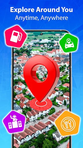
See The App In Action


Trusted By Millions Of Travelers
Very nice app for my work. I frequently used this navigation app. It's traffic live updates are very much helpful for me
I've tried a lot of apps with a similar purpose but this is by far the best. Easy to use. highly recommended. 👍👍
Fast and user friendly map. Love the "live traffic" and "Route Finder" options. I recommend it.
Great job , being i driver i recomend all driver to install this perfect and accurate app
What a mind blowing experience with this app, also very helpful and easier to use.